Skip to Content

Some Photos of Where the Road Ends

up
630 users have liked.

A complete dead end to all the work.
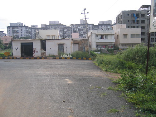
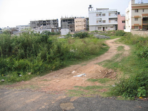
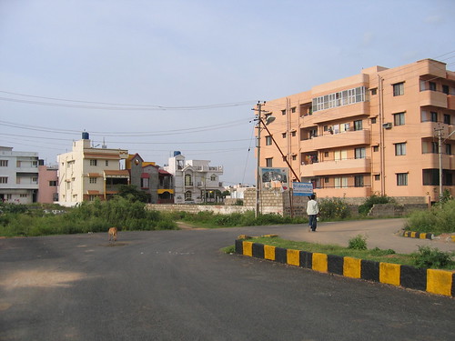
Here are some photos of where the Road really ends. If this would have continued, then it could have been connected to the BTM road which goes just beside the lake. But i feel and if i am not wrong, this road is never going to be continued and we would have to suffer for long time, as lot of buildings have already sprung up and it cannot be demolished. These buildings were not there a couple of years ago.

You can see in the below photo vijaya bank colony in the back, and how the road ends.
You can see in the below photo how buildings and apartments have sprung in past one year, which completely puts an end to this road.
Finally we can see the road ending...
A very sad state of affairs that we are living such a country and still have to spend some 30 years, living in this country. that we are still being exploited ........ in this 21st century ........

Comments

Visitor's picture

WOuld like to know the following

I would like to know the following.... Planning raod planning maps from past 4 to 5 years. If we see road planning maps of 4 to 5 yrs, then sure we would be able to see, that there is a connection to this road. In past couple of yrs we have seen, encroachments. Layout maps 5 yrs before and now, in and around vijaya bank colony. Here also you can see some layouts which were would nt have been would have propped up. By comparing these two, we can obviously figure out... Until unless they have changed the old maps after pocketing money...... -- I hope we can figure out something, pls post it on praja if you are able to get hold of these... Thanks a lot ....
tsubba's picture

details

hi thanks for that input. please consider registering. readers cannot make out if you are the same visitor who posted on the other thread or a different one. we need to collect details like the official name of the area. (i tried looking at the ward no and exact contact nfo, but the BDA site is down). i dont think there are separate road maps and layout maps. imo, there are only layout maps in which the roads and their width are also marked.
tsubba's picture

RTI

Do you have any particular question that you would like answered through RTI? i was thinking it might be useful to ask for the planning maps for the area so that we can see if it is indeed how they designed it, or if there have been deviations. in either case this is a major screw up. it is hard to imagine that for an area approximately 3km x 3km, with so many businesses and industries they have only two approach roads.
Madhu's picture

Bannerghatta road

Why isn't an RTI request being made on this, so that the truth comes out? I had to sell off some property at loss some years ago, due to the horrible approach to the surrounding areas. This city has been led down the drain by corrupt netas and babus.

Praja.in comment guidelines

Posting Guidelines apply for comments as well. No foul language, hate mongering or personal attacks. If criticizing third person or an authority, you must be fact based, as constructive as possible, and use gentle words. Avoid going off-topic no matter how nice your comment is. Moderators reserve the right to either edit or simply delete comments that don't meet these guidelines. If you are nice enough to realize you violated the guidelines, please save Moderators some time by editing and fixing yourself. Thanks!


about seo | book