
Tale of Hebbal station


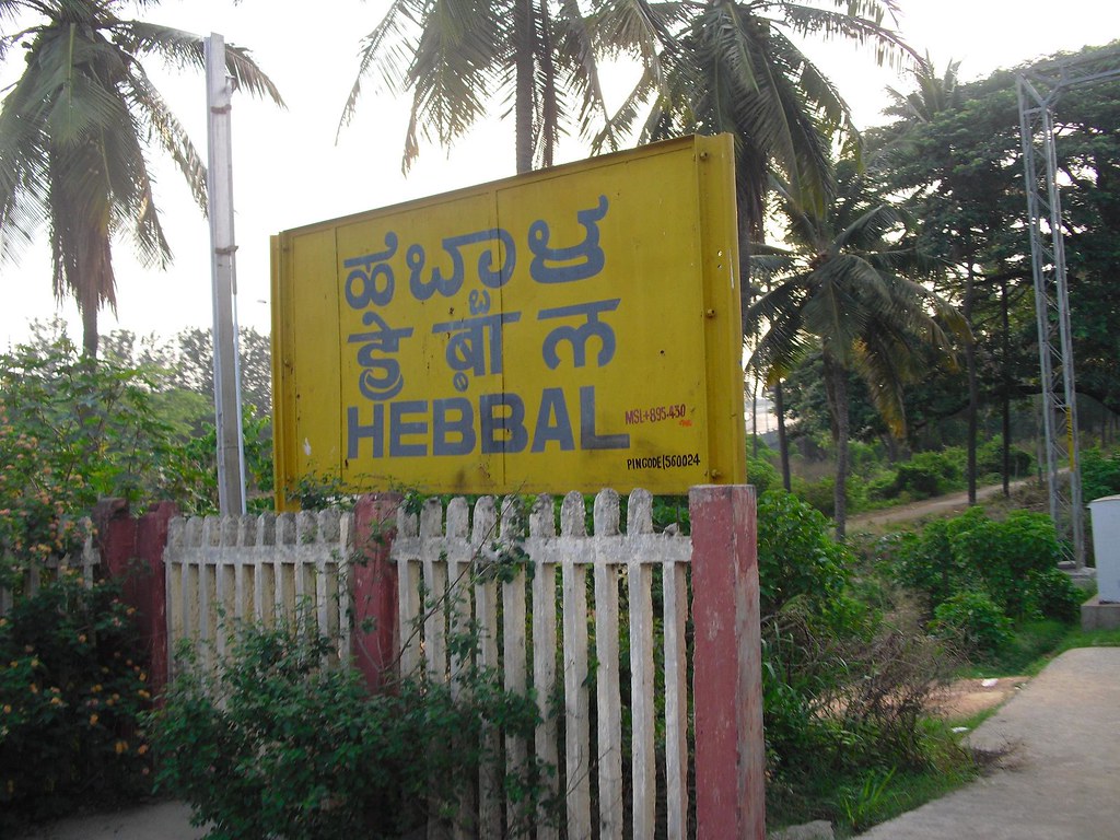
Hebbal SWR station located in ward 20 adjacent to the ring road services wards 19, 20, 21 on the inside & ward 8 on the outside. The demographics of these wards lend itself to heavy public transport usage. Let us look at this station from a CRS standpoint
The station itself is bare and clean. The reservation counters are empty but the station manager is helpful in printing tickets to those who ask. It has 2 platforms with tracks in the middle. Only the platform closest to the entrance is used by the YH1 CRS train. This is possibly to prevent crossing over from the other platform as you will have to walk on the tracks to cross over.
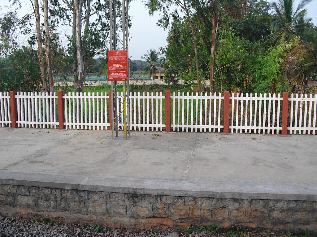
Hebbal station looking towards Yeshwantpur
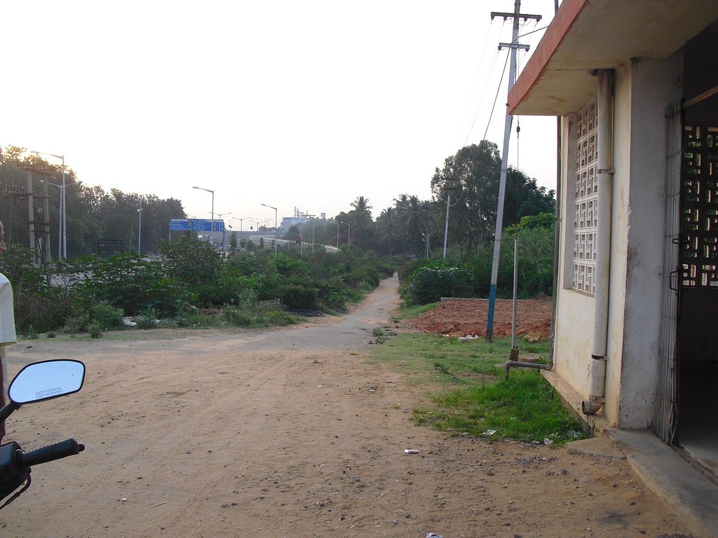
The entrance to the station is on the Ring road side.
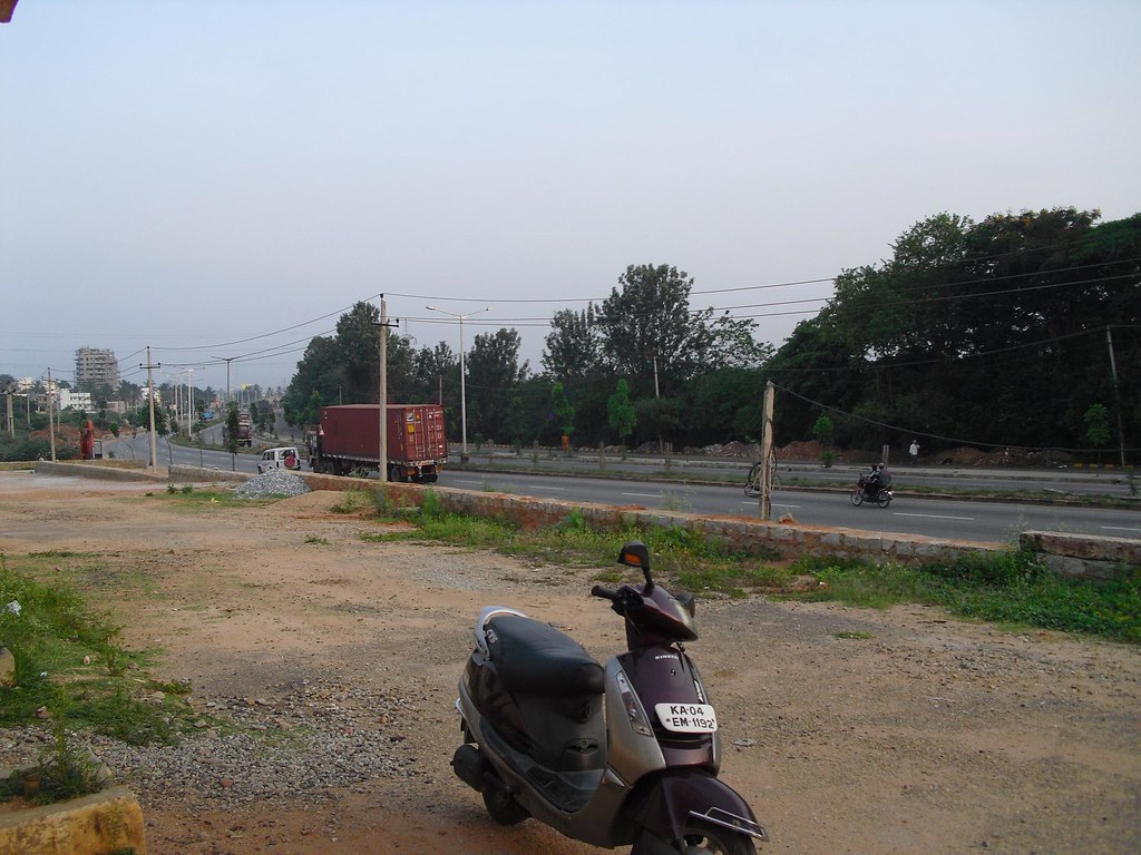
Ring road west (towards Yeshwantpur) from station entrance
Ring road view east towards Hebbal flyover - Notice path to bus terminus
Primary problem with this station like many others on the CRS route is making it accessible from all sides via feeder service. While the access to wards 21 & 8 can be had from the ring road side. Wards 19 & 20 are totally cut off.
From station looking south towards Bhoopasandra main road. No access to the south from station despite being 100 mtrs away
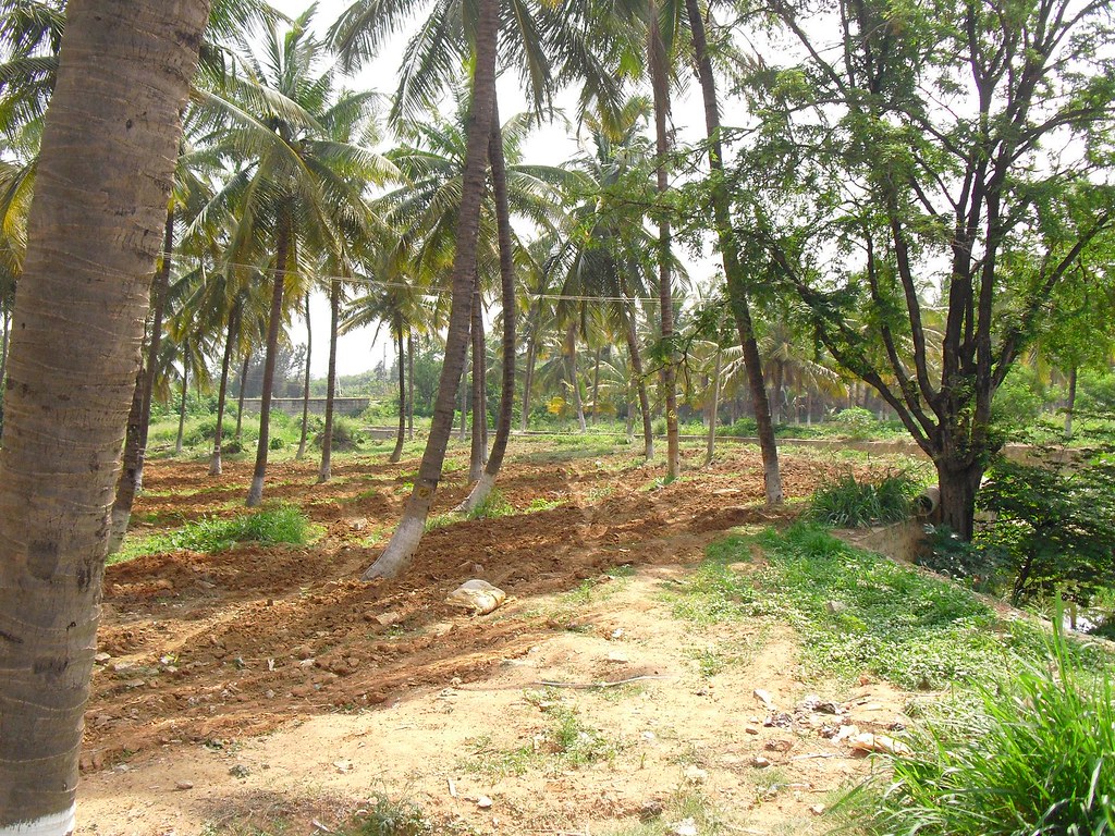
Looking from Bhoopasandra main road to the station. The coconut & Sapota grove seperate wards 19 & 20 from the station
Current accessibility challenges
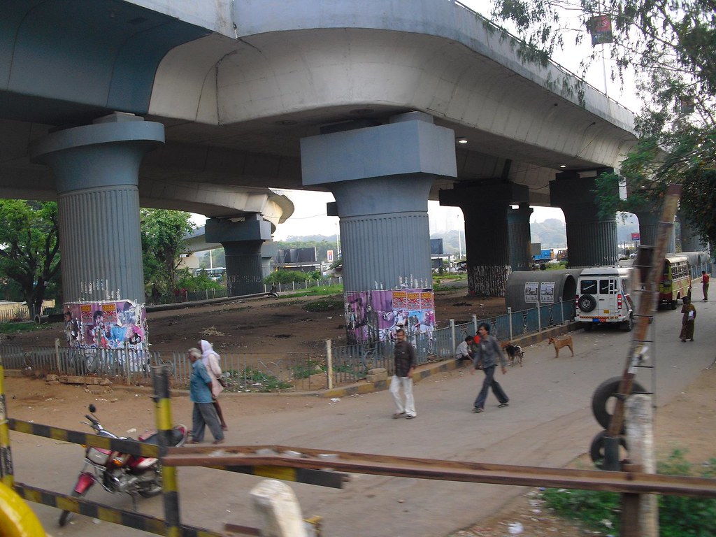
Hebbal station is fed by buses upto Hebbal bus terminus under the flyover. The station is a 300 meter walk from under the flyover.
Notice the pathway to the hebbal terminus in the distance. This is from pre ring road days where the Lake extended closer to the station
1. Most buses that arrive at this terminus are long distance, they dont service the immediate catchment wards mentioned above, except via trunk roads of Bellary road & ring road.
Taken from south side of the track, notice the bus terminus between the pillars
2. The bus stand itself might be shifted farther away towards the Nagvara side across the ring road at a future date and hence making it more inconvinient and possibly cutting off the integration altogether.
3. The present Hebbal bus terminus to Station is still a hurdle for the aged and disabled as the walk is substantial along the pathway.
Pre-ring road era pathway to the station from the flyover/terminus
The nearest bus stand to Hebbal station on the inside is Bhoopasandra bus stand at the border of ward 19 & 20 which is at the same distance from the west end of the platform as Hebbal bus stand is from the east end.
Top left to the end of the road is Bhoopasandra bus stand which serves wards 19 & 20. Across the coconut grove on the right is the Hebbal station with no access path
Solutions
Short term
Current schedule of YH1 makes it stop at hebbal only 4 times in a day.
1. Extend the bus from Bhoopasandra bus stand to stop at the Hebbal bus stand under the flyover on the south side coinciding with the 4 stop times allowing 15 mins for the 300mtr walk form the Hebbal bus terminus
To the right of the poster pillar is a defunct bus stop. The only bus stop to the south of the tracks which is near a cross over point
2. Run special feeder for catchment areas to Hebbal bus stand on both sides
Long term
Long term schedule of YH1 will become 1 every 20 or 30 mins.
We need to make buses stop on both North & South sides close to the station. This solution will work even if the Hebbal terminus moves elsewhere at a later date.
The existance of the Hebbal bus station under the flyover has caused a lot pedestrian cross overs which can be dangerous for a frequent operation of CRS. Hence the move to a more permenant location should be welcomed.
While the south bus stand can be the Bhoopasandra bus stand, the northern side will involve stop across the ring road on the far side for buses heading east and on the near side for Buses heading west.
A single subway from Bhoopasandra bus stand all the way across the ring road till Hebbal lake will serve the purpose. This subway will have 4 exists, 1 for each platform and one each for the bus stands on the ring road. On the southern side of the Station the access can be at surface level over the drain running across the coconut grove. This subway will prevent crossovers under the flyover.
Notice the drain running to the right of the picture. It goes all the way near the station across the coconut grove, A pathway either on it or across this grove can continue below the raised station as a subway and under the ring road all the way across.
- Printer-friendly version
- Login or register to post comments
 ಈ Project Blog ಅನ್ನು ಸ್ನೇಹಿತರಿಗೆ ಕಳಿಸಿ
ಬಳಕೆದಾರರ ಲಾಗಿನ್
Recent comments in this project
Bangalore Public Transport
- BRTS, Bus Priority or similar concepts for Bangalore
- Bangalore Transportation: Research and Reports
- Bangalore CTTP 2007
- CTTP Bangalore Executive Summary
- Chapter–1 Introduction
- Chapter–2 Study Objectives And Methodology
- Chapter–3 Existing Traffic And Travel Characteristics
- Chapter–4 Development Of Operational Travel Demand Model
- Chapter–5 Strategy For Transport Development
- Chapter–6 Future Demand Analysis And System Selection
- Chapter–7 The Traffic And Transportation Plan
- 7.1 Components Of The Traffic And Transportation Plan
- 7.2 Mass Transport System
- 7.3 The Metro Network System
- 7.4 Mono Rail / Light Rapid Transit System (LRT)
- 7.5 Commuter Rail System
- 7.6 BRT System
- 7.7 Augmentation And Improvement In City Bus System
- 7.8 Integrated Multi Modal Transit Centres –Cum- Intercity Bus Terminals
- 7.9 Road Infrastructure
- 7.10 Inter-Modal Interchanges
- 7.11 Non- Motorized Modes
- 7.12 Parking
- 7.13 Freight Movement
- 7.14 Demand Control
- 7.15 Transport System Management - B-TRAC 2010
- Chapter–8 Transport Integration
- Chapter–9 Cost Estimates, Phasing And Financing Plan
- Chapter–10 Institutional Development
- Bangalore Mass Transit - Summary of Past Study Reports
- CCTF Report
- Traffic/Transport Issues & CTTP-2007
- CTTP Review – Further Comments & Inputs
- CTTP review comments
- Part I: BRTS
- Part I: Monorail
- Part I: Airport Rail Link - The Monorail Option
- Part I: Commuter Rail System
- Part II: Non-Motorised User Facilities
- Part II: Traffic Restraining Measures
- Part III: South East CBD areas not connected
- Part III: ITPL and surrounding areas not covered
- Bangalore CTTP 2007
- Bangalore bus system
- BMTC Routing
- Ask Me service - Query on BMTC routes
- BMTC - Interactive Maps Project
- BMTC route allottment - sheet attached
- Case Study: Taking the Bus
- Routes introduced after February 2010
- The Big10 routing concept
- BIG10, KSOL, KSBL - Route Details
- BMTC - S1 Route (Vijayanagar to Vijayanagar)
- BMTC Big 10 and HOHO service: work in progess?
- Bellary Road Big 10
- Big10 - 5 things to build upon BMTC's direction-based rework
- Big10 concept - Circle Routes are here?
- Extend or overlap BIG 10 services
- HOHO off to a slow start
- My experiment with the Sarjapura road Big10
- Tried office commute using Big10 - a report
- BMTC and Corruption
- BMTC and monopoly - opening up Local Bus Transport in Bangalore
- BPS Concept Paper
- First and Last Mile connects for BMTC
- Feeder Routes as 'Branded' Service
- BMTC's encouraging mini bus talk - good going Mr Parwez
- Feeder Bus Service - Malleswaram Example
- Minibuses for better area coverage
- No bus connecvitity from Kaggadasapura, Vignana Nagar to HAL airport Road!!
- Shuttle suggestions based on our experiences
- Feeder Bus Routes for Areas East of Suranjandas Rd
- Information Available on BMTC
- Vajra/Volvos doing well
- BMTC Routing
- Commuter Rail Service
- CRS Bangalore: A project that never gets the green
- CRS for Bangalore
- Commuter / suburban rail - part II
- Commuter Rail - Will it ever materialize ?
- Commuter Rail - Will it really help ?
- Commuter Rail System - for us?
- Commuter Rail can make our city better
- Commuter rail for Bengaluru - state not interested?
- Commuter rail to E-City may happen soon!
- DRM's presentation (regarding Commuter Rail etc)
- Edge stations, ring rail, and leasing or acquiring SWR assets
- Imagine Sarjapur suburb area, with Commuter Rail
- Nayandahalli Station Should Be Improved
- Report - Bangalore local train ride & meet
- South Western Railway - please wake up and listen to us!
- Tale of Hebbal station
- Updates from the Railway Minister
- Using the present Indian railways as Commuter rail in Bangalore
- Transportation Solutions for Bangalore
- Economical Transportation Solutions for Sustainable Bangalore
- External Links (related work)
- Metro Rail too much to handle - Can we leapfrog...
- PIL - To Sort out the Transport Mess
- Tax Sops to encourage use of Public transport (BMTC) ?
- Urban Transportation reforms around the BMLTA concept
- Bengaluru Light Rail





ಪ್ರತಿಕ್ರಿಯೆಗಳು
Hebbal station
Leave your analysis & solutions for increasing accessibility and improvement of Hebbal station here. For the rest go here
Awesome report,and guys, open your eyes
Awesome report IDS
So who all noticed how close to outer ring road, and also the Bellary Road this Hebbal station is?
Can you even imagine the possibilities? Bus hub near the station, crowd comes from yelahanka side, and the moves on towards East, or South side of the city. Or go west towards yeshwantpur, catch a metro to Jayanagar right there, and you have yelahanka to almost anywhere in the City area in 40-50 minutes with easy changes. Why do I say easy changes? Because chaning trains is a lot easier (for commuters) than changing buses.
IDS - how was the space around tracks from Hebbal till Belandur Road? Any problem points for doubling this track that you noticed?
Land available
Any problem points for doubling this track that you noticed?
None whatsoever! Even in the most crowded parts between Hebbal and Byappanahalli there is railway land available for an extra track.
Bus & Train
The bus & train tickets can be integrated, to start with by allowing BMTC daily passes on local trains and sharing the income.
This will spread the traffic more evenly and result in lesser traffic congestion on roads and inside buses, better utilization of train services and many other benefits.
K.V.Pathy
Bhoopasandra to Hebbal
Good report..... Few points from my end.
1. Many residents from bhoopasandra, sanjaynagar/nagashettihalli avoid the station because of the approach road .
2. Extending the bus (279,278) would be a good idea and also new feeder network keeping in mind HSRL and metro introduce buses between YST -> Mathikere -> Hebbal.
3. Any development should not loose the green space around.
Being one of the residents, would be a one of great help to local community.
Regards
Vinod
new feeder network keeping
new feeder network keeping in mind HSRL and metro introduce buses between YST -> Mathikere -> Hebbal
This is a long pending demand. See here
Access from south
Any development should not loose the green space around.
A simple covered walkway across the field from Bhoopasandra main road with non concrete wood/steel floorboards and a grill on the side between the trees will make it cheap and efficient. Not a single tree needs to be felled. The drain which was recently fortified can also be used for this purpose.
Once the walkway reaches the station (which is at a raised level) it can become a subway constructed through box pushing technology. You dont even need escalators to the 2 platforms & on both sides of the the ring roads, sloping ramps will do.
Considering cut & cover for ring road, box pushing for under the platform, ramps for walkways, all steel walkway and no utilities to be moved. This shouldnt cross more than the 16 to 20 crore underpasses built across town.
24 hours for the underpass across ring road, 1 month for box pushing, 15 days for walkway & 1 month for fit & finish, we should be done in max 3 months post tender. Side benefit, the subway will make Hebbal lake a short walk for the many residents of wards 19 & 20
Taking it forward
This is an excellent analysis and the suggested action plan is great stuff. Plus the 'side benefit' of access to the lake is, imho, a deal clincher.
The question that remains is how to go about getting action on the ground. One way would be to write to the newly elected councillors for these wards. They should be eager to push forward a project that benefits their constituents and can be highlighted as an achievement in the next election.
Action on the ground
One way would be to write to the newly elected councillors for these wards.
Yes that is the best way to take up these projects in isolation.
Long term, The overall CRS plan has to identify roles & responsibilities of each facility and who will do it. Who will build stations? Who will run trains? Who will build signalling? Who will maintain facilities? Who will provide subways & access roads? Who will run feeder.
Building integrated transport systems are not easy and our politicians only make it harder.
Excellent coverage about hebbal station
Excellent coverage about Hebbal station. But it is unfortunate that only one train stops at Hebbal Station. Even if you are staying at Hebbal, you are taken to Yeshwantpur all the way and you have to catch an autorickshaw (after the usual hagling about the fare) and head back to your home. A waste of about one-and-a-haf hours! that too in this modern age where time cannot be wasted at all. This also adds to the carbon emission on the roads by forcing one more autorickshaw (which is a great polluter anyhow) on the road.
What I suggest is all incoming and outgoing trains should have a 2/3 minute halt at all the Railway Stations in Bengaluru so that people need not spend on extra transportation to and fro the Railway Station which will also help in reduction of unwarranted carbon emissions.
What I suggest is all
What I suggest is all incoming and outgoing trains should have a 2/3 minute halt at all the Railway Stations in Bengaluru
Here is an example from Netherlands
Stations are divided into three categories. These are, in order of decreasing importance:
Rapid trains are usually intercity and stop trains are suburban.
If you took a rapid train you will have to get off at intercity/rapid train station and then catch the next stop train to your neighbourhood station. In our case rapid trains will be the intercity passenger, Intercity will be our point to point non stop express trains and stop trains will be our CRS
So if city & cantt are our intercity stations, Yeshwantpur, Byappanahalli, Banaswadi, Yelahanka are our Rapid train stations then for Hebbal you can either get off the rapid train at Banaswadi or Yeshwantpur and catch the suburban stop train to Hebbal. Or if you came to city in an intercity then you have to rely on a metro to either go to Yeswantpur and then a stop train to Hebbal or take a bus to your nearest stop.
All this requires good frequency of stop trains at 15 - 20 mins in each segments and also a good information system.
(non) Access from
(non) Access from Lottegollahalli station to Kuvempu circle bus stand
You can see the bus at the far end of the picture, zoomed below, that is the bus stand. I am sure it wont hurt them to pour some asphalt on the pathway and put up some street lights
Access from Lottegollahalli station to Kuvempu circle bus stand
This very much true, their is no path way, no lighting. Their is no proper bus stand at Kuvempu Circle. Bharat Electronics ( BEL ) factory is hardly 100 Mts from this station. Authorities should develop these such places so that commuters will feel more easy to use commuter railw ith BMTC.
sanjeev
brilliant !
@IDS
What the city needs is a Commissioner of your calibre, with praja.in as the platform for the city's upper house. That will be the day!
Meanwhile, let's get cracking on making a presentation to the local Corporators, as also the Mayor, and Dy Mayor. Let me see if I can manage it through my sources. You try yours too.
Byappanahalli station
Here is a good perspective view of Byappanahalli SWR station & the adjacent metro station coming up, shot by nandan_ks. Click for bigger image.
There definitely will be clogging if this station will be used as a terminus as, from the pic, there are only 2 platform tracks for short stopping of trains without blocking the pass thru double tracks.
Hebbal station
The Hebbal Railway station is an unofficial suburban rail for hundreds of IT professionals travelling to Electronic City. The station is also used by flower and vegetable vendorsfrom places like Salem and Hosur. The station may not have too many trains passing through, however, the four trains that stop here see hundreds of people embarking at the station. Yet, the station is in a pathetic condition.
Source
Foot Over Bridge needed, citizens are using only