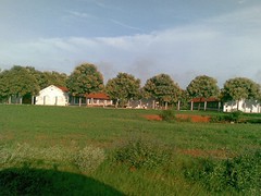
 Its an open secret for us in Whitefield area by now. There is this scenic route that skirts around city's mad traffic and takes you to BIA in an hour, any time of the day! The drive is just under 60 km, point to point. However, listen to this, last 18 kilometers are spent circling around BIA only because there is no entry to the airport from the East side. Some pictures for you, and the route map as well. Basically, you go from Hope Farm junction to Hoskote, on to Budigere, and then to the airport via a village just north of it, or via Devanahalli itself which is much further north of the airport.
Now, here is the map to explain the wasteful last 15 kms on the route. If BIA can build an entry from the east or south side, this route would be shorter by 10 km or more. Blue rectangle is the airport, green is the route available today. If they do the reds marked here, we'd save 10 kms or more.
Here are some pics from this scenic route. I am not sure how long this route will remain this way though :)


ಪ್ರತಿಕ್ರಿಯೆಗಳು
BIA should show initiative
I am sure BIAL would have more than enough money to purchase lands at even "black" market rates there. The government, i.e KRDCL (Karnataka Road Development Corporation Ltd) and other agencies such as KIADB should be only to glad to help.
These are such low hanging fruits which we people fail to realise and try to catch first.
BMLTA's HLTF talked about it
I remember Devesh telling me that they had brought this up in their HLTF (a jargon for High Level Task Force for connectivity) meeting convened by BMLTA. So something must be moving on this, though slow.
KRDCL has invested a lot in making these alternate roads from Budigere side to reach BIA. They must push BIAL to make their investments worthwhile. Roads have really been done very well. Last week, my cab driver happened to be a resident of Budigere himself and joked that thanks to the good road and airport, his property price has jumped from 20 lakhs an acre to almost 2 crore and acre now, in just about two years. I told him sorry, I am not a builder:)
HLTF
Yes, the HLTF is the High Level Task Force. It is listed on BMLTA website. The target was 1 hour from any part of Bangalore. I do not see this being achieved any time soon. In the HLTF many officers were complaining about the lack of support from BIAL on connecting all the roads on which the state government has already spent some Rs. 1600 Cr. BIAL was accused of being loathe to part with one inch of their ground for purpose of a road.
If you see the map, another option is SH104 via Bagalur. The ORR to Bagalur part has been done. The Bagalur to NH7 is in shambles. That road comes out right near AFS Yelahanka.
Once the NHAI begins construction of the double decker from Hebbal to Yelanhanka, the pressure will increase once again.If the NHAI's plan to put trucks on NH4 on to NH7 via Dobbspet - Devanahalli down to Hebbal and on to ORR is implemented, it is good night.
-----------------------
Regards
Devesh R. Agarwal
Visit my aviation blog at http://aviation.deveshagarwal.com
Regards
Devesh
Bangalore Aviation
Enjoy life, destroy FUD
Commuter Rail between Chandapura (EC) and BIAL
that comes next
cadambi - CRS to airport is step 2 or 3. Lets raise the pitch on CRS first. For CRS to connect to airport, there will need to be a shuttle or light rail type service from nearest station to the BIAL terminal itself.
I have flaoted mails to see interest for CRS in CAF group. cadambi, we have you, me and Gautam here for sure. 2-3 more people, and we can start meeting people for CRS. Lets do that via a separate thread. That edge station post, or a new one if you have more ideas and information on CRS.
About this 'low hanging' fruit, we need to have BIAL approach done from south, east,or north. Overloading NH7 alone may work right now, may be for another year, but not beyond. Once economy rebounds, air traffic zooms again, we'd be crying over these missed opportunites to create more approaches to BIAL.