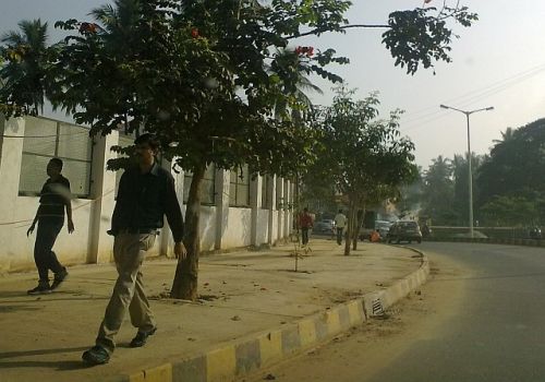
Walking in Bangalore - Amenities for Pedestrians
Too much stress on road width for vehicles has eaten up pavements and encorachment of pavements for purposes other than walking is also on the rise. Talk of signal free corridors etc also means bad news for those who regularly cross these roads.
This wiki/book is to hold together references and popular discussions on pedestrian infrastructure in Bengaluru.
17% people walk in Bangalore


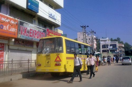
 Private vehicles in India account for 67.5% of motorised vehicles, carry 37% of the commuters and take up 67% of the road width. Buses account for 24.5% of motorised vehicles on the road and carry around 61% commuters, taking up 38% road width.
Refer: 17% people walk in Bangalore
BMLTA Pedestrian and parking policy report
BMLTA has come up with a draft pedestrian and parking policy. The vision seams to be in the right direction with emphasis is on pedestrians infrastructure including footpaths and crossings.
The parking policy talks about re-introduction of paid parking and steps to put in place a sustainable parking infrastructure (parking complexes). It also talks about secure parking spaces for cycles.
The "Policy for Pedestrian Movement in BMR" can be accessed here.
and
"Policy for Parking in BMR" can be accessed here.
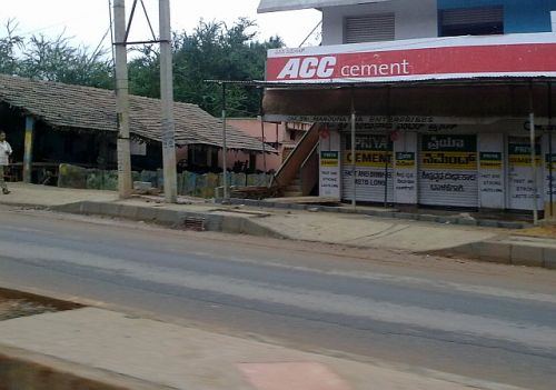
Bangalore's new Skywalk locations
BBMP has come out with an EOI document for construction of 56 Skywalks with escalators in 14 packages, here it is (link to pdf)
Some of the locations that stand out in terms of utility and usefulness are,
- Arya Bhavan Sweets to Kanthi Sweet to Himalaya Theatre, crossing KG Road
- BTS(sic) Main Bus Stand to Amar Lodge Building in Majestic Area.
- BTS(sic) Main Bus Station to Railway Station Premises
- In front of Satelite Bus Stand on Mysore Road.
Some locations with questionable utility and usefulness to general public,
- In front of Shopper’s stop (Mantri Elegance) on BG Road 1 no
- On Hosur Road "T" Junction with Tavarekere Main Road (Opp. Said Sadan &Prestige Acropolis) (High Rise Apartments Condominium)
- Near Bhagwan Mahaveer Jain Hospital, College and Nursing On Miller Road.
- Queen’s Road near Congress Office.
Dividers make it difficult to cross roads
A divider has been put on on the Jaymahal Main Road. This divider has quite a height making it really difficult for the walkers/pedestrains to cross the road!! The pedestrain/walker faces problem as there is no place for the person o cross, one has to literally jump over the divider in order to cross the road, thus risking one's life as there is heavy traffic on both the sides of the road, making it even worse for the older people and women!
It would be of real relief if there was a little gap in the dividers, so that road crossing om Jaymahal Main Road is no more a pain!!
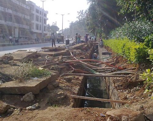
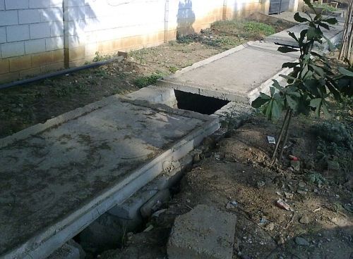
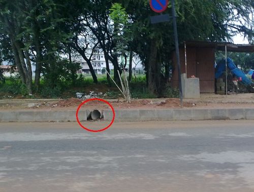
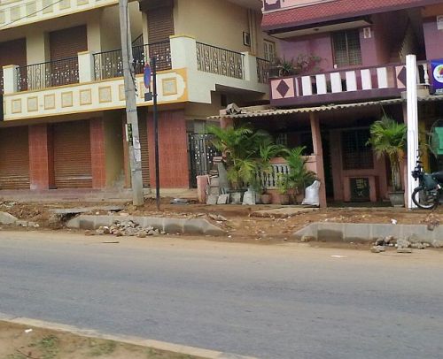
Footpaths upgraded but width reduced
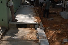 I live in Kumarapark (BBMP Ward No 77) and i was initially pleased to see the footpaths getting a face lift. Yes Serpentine road is having spanking new machine finished granite slabs to cover the drain and make for the footpath.
We are talking 5' X 2', 3'' thick slabs! Wow, isn't that sort of expensive? bout 100 Rs per sq foot. (i was told so by the contractor)
So why this report? I am sad to tell you that these footpaths are now 2 ft narrower and the way its being constructed looks like its not going to be usable.
Check out some pictures:
New Footpath narrower than the old one
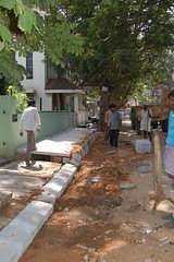
Check The height of the kerb in the next picture, and to accommodate for the entrances to the houses, we have a step of 1.5 ft to 1 foot every 20 feet, this makes the new footpath unusable.
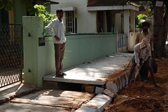
This picture tells you that the kerb height is almost knee height! Cars parked close to the footpath, the door may not open which means people will have to park towards the center of the road making the road appear narrower too.
Neighbors asking the contractor why this is such a bad job - while he smokes the problem away (next pic)
Existing Footpath being removed - opposite side of the road - this footpath is about 8-9 ft. I only hope this too is not going to be reduced to 5 ft.
When I contacted the President of the Kumarapark resident welfare association, Mr Ramakanth he gave me the reason that we residents park our cars on the footpath which is why this high kerbs are being put up. Though there may be some truth in that, I find that terribly lame.
I was asked to contact concerned BBMP engineer No 9880580712 (Asst Engineer Ibrahim) , how ever when i called this number there was no response. More so this solution not only makes the cars not use the footpath now the cars are going to be parked away from the footpath making the road too unusable.
I hope the concerned authorities look into this before more damage is done.
I also request other members who are more knowledgeable in this matter to throw some light on the specification for kerb sizes in residential areas if any thing like that exists.
I am happy that my locality is getting this face lift, on the other hand It also occured to me why not take up footpath works in dense pedistrian areas such as Gandhinagar or mejestic etc where the footpaths are in worse conditions.
For more pictures visit http://flickr.com/photos/...
--
Praveen Sundaram
Aka
PhotoYogi
IRC guidelines on pedestrian facilities - summary
I will split this in to following parts -
- Summary of IRC on above topic
- What is missing
- What we should do to fill in gaps
- Action the above by getting local civic body to ratify document Praja creates after step 3
- Forward plan
Summary:
General: 3 revisions (1980, 82, 87), finalised in 88
Introduction: Walking is an important mode of transport. Significant trips up to 2 km are on foot and every journey starts / ends with a walk. Requirements partly also covered in IRC:70-1977 Guideline on regulation and control of mixed traffic in urban areas and IRC 86-1983 Geometric design standards for urban roads in plains.
General Principles:
- Pedestrian facilities should be planned in an integrated manner to ensure continuous flow.
- Reduce conflict between pedestrians and vehicles.
- Convinience is paramount.
Footpath / sidewalk:
- Should be on both sides
- Minimum width 1.5 meters
- There are criteria based on pedestrians per hour and width of footpath may have to be as much as 4 meters
- In shooping areas, width should be increased by 1 meter (to be treated as dead width)
- When adjacent to building, fences - dead width has to be 0.5 meters
Gaurd rails: This is covered next, but I won't go in to it right now (the aim is to first get footpaths, rails come later).
Pedestrian Crossings:
- Types - at grade and grade separated
At grade crossings (crosswalks): Covers both - crossings at intersections and mid-block, can be controlled / uncontrolled by signals.
- Zebra width - 2 to 4 meters
- Not within 150 meters from each other
- Median strip should be adequate width (this is the only reference to pedestrian refuges)
- Mid-block crossings should be provided when distance between two consecutive intersections is more than 300 meters
- Controlled crossings - warranted when one or more of following apply - peak pedestrian volume per hour (P) and vehicles are such that PV (V is squared) more or equal to 10 to the power of 8, approach speeds 65kph, wait times for pedestrians are too long (time not specified) and finally accidents records indicate 5 or more pedestrian injuries a year (not deaths, so threshold is low)
- Control measure could be a push button pelican signal when pedestrians are fewer.
Grade separated: subways / foot over bridges - 2.5 meter width and height, but 4-6 meters width is advisable (there are criteria based on capacity considerations)
What is missing:
- No mention of right of way for pedestrians at non signal controlled zebra crossings (though delhi police website says so).
- No mention on height of footpaths
- No mention on dipped kerbs and gradients
- No mention of slip free tiling (needed usually on dipped kerbs)
- No mention on pedestrian refuges and types.
- Signal phases are mentioned but no guideline on timings
- No mention with regards width around street furniture (bus stops, trees, benches, bins, electricity meter boxes, post boxes, signage poles, street lighting, telephone company boxes, etc).
What should we do to fill the gaps? Praja may recollect I had started to create a good practice resource page, many link within that page are relevant. We could (or a WG) study the international practice to enhance and complement IRC norms and then create a draft and get civic body to ratify it (that will be step four).
ASJ
Pedestrian Subway - Change In Design
In the recent past, many pedestrian underpasses have been built at various locations. However, the utility of these for pedestrian crossings has been minimal & one hardly finds pedestrians using them, unless forced to with barricades (eg. Pedestrian subway at City Railway Station, & at KBS).
This raises questions as to why they are ignored by pedestrians. One obvious reason is that everyone prefers to cross a street just about anywhere based on individual needs & requirements. The other, not so obvious reason is the discomfort in using them, especially for old people, small children, disabled people & pregnant women. The ordeal of descending about 8-9ft & climbing up again is perhaps a strain even for ordinary people when coupled with walking, sometimes long distances. Overhead walkways are even more uncomfortable for people as they have to climb even higher & then descend back to street level (about 12-15 ft or more, in some cases).
BBMP may claim to have addressed the needs of pedestrians by building these, but in the larger interests of users, a solution is necessary to ensure that these do not remain mere showpieces.

What if we make the subways as shown in the sketch above ? Position the subway midway below street level so that pedestrians need only descend about 4 feet instead of the usual 8 ft or more. Needless to say, an elevation of the road would also be necessary, stretching over a length of a mere 55 ft, or about 17 mtrs for a gradient of about 10 degrees. This rise in street level will also ensure that pedestrians do not cut across the street over this stretch & will have no option but to use the subway. Sidewalks will need to be maintained at grade, throughout & preferably barricaded for safety of all.
If designs that do not require pedestrians to physically stress themselves are adopted, such as the example above, we might see better utilization of pedestrian subways.
Appreciate your inputs & ideas in this regard.
Quality footpaths from BBMP - good going at Whitefield
When you see good work, you must appreciate and encourage BBMP. Its not covering all corners of Whitefield, just the main roads. But as they say, level of development of a city is determined by its footpaths and pavements, not the roads. And this is a good beginning.
It started in October I think when material started showing up around the roads
Work began soon after, and there was a bit of a mess. In some cases, irregular pavements done by shop owners and businesses were removed.
One more
Drains on the side were covered, and were connected with the road via a duct under the footpath.
And in a month or so, the footpaths have started emerging, all cement, no irregular stones designed to make you stumble, and notice the slopes around entry and exists to the main road.
Better one here ...
With pavements like this ...
... for once, looks like we will get what we can really walk on, with comfort and without obstructions.
What is the story elsewhere in Bangalore? I see similar work in progress in many areas, does everyone like the work being put in around Bengaluru?
Redesign of Hosur Road as model road : Footpath and cycle tracks
Background: Had an unplanned meeting with BBMP, thanks to Ashiwn/SB. Part of our initiative for better road design. This was at an hours notice on a weekday and was pretty much took half the day, so was not a good candidate for an event. Anyways, we discussed the pedestrian infrastructure, footpaths etc. We know that the quality needs improvement, and I have already documented what goes into footpath design, which I shared with BBMP folks. In general they seem appreciative and want to improve. It helps if we give specific inputs in a structured manner, rather than just rant and crib.
Footpath material: So here's where we can help. They want to do Hosur road, from Silk Board junction to Vellara as a model. This will have pedestrian and cycle tracks !. The total width of the footpath plus cycle track on either side is currently planned around 3.5m. Of this there is cobbled stone (interlocking pavers type) on the first 1.5m, There is a drainaige of 1.4m plus an additional overhang of 0.6m totally 2m which will be joined slabs. These do not give good finish and they are planning to put a paving over this. One specific suggestion asked - any suggestion on paving material/colour which will be suitable and look good ?
Cycle track: Am not sure we can change the course on this, but let us discuss and if there is something that makes strong sense, we can atleast try to influence. Its not as easy as lets put a cycle track ). At this point plan is 3 lane carriageway each side, we are left with exactly 3.5m on either side.
First is its location : Should it be road - footpath - cycle track : boundary or road - cycle track - footpath : boundary. Advantage of former is cycle track is better isolated, disadvantage if shops exist on the road then there will be too much pedestrian interference. This is the current plan. Disadvantage of the latter is if the cycle track and footpath are at same level (slightly elevated by the kerb height from the road level) then the cyclist can fall off on the road. This neccistates the use of verges in between, and if we go by IRC, we need 1m on each side, a precious waste of space. Dont have that kind of space
Second is the space required: A cycle width is upto ~ 60cm. You cannot drive a cycle on a straight line, with a 20cm margin it is 1m, you need to allow at least two cycles side by side which makes it 2m. This is the minimum IRC standard for dedicated cycle track, danish standard for eg: is 2.2m. Right now we have exactly 2m, and footpath of 1.5m which is again minimum prescribed. This is not going to make cycle driving very pleasant however.
One thought: Combine cycle tracks to a single side. This will give a lot of space for cycling, part of it can be a verge barrier etc, make it pretty and nice. Does this result in too much of cross movement ? I think we can give longitudnal parking for cycles along the track, people can walk across to shops on the other side. If they want to take cycles, they will have to walk with the cycle on the footpath on the other side. for the length from the crossing.
Alternate thought: Dont combine cycle track along with footpath. Instead put it at road level and put kerb stones as seperators from the road. Much safer for cyclists (dont fall of the kerb), plus get better seggregation. Doesnt look as good aesthically and may not be implementable in the current scheme of things - need to check
There is always the 'we can get more space from somewhere', or remove a lane etc, but what is the best that can be done in the given situation ?
I will continue to post on this blog for further thoughs/updates etc. Please feel free to give whatever thoughts you have.
Road width over pavement - Marathahalli example
First of all, credits to BDA or BBMP or ABIDe (who knows!?) or whoever is thinking about bus interchange points like Marathahalli ring Road and improving the pedestrian amenities there. So yes, something is better than nothing. However, if you watch the work, uncalled for and unscietific preference to road width over pavement is visible. Sample some pictures.
What do you see above? The dusted portion of road is appx the increased width available due to embankments on the road edge. This road is an entry into ORR. It does not need more than two lanes. And pedestrian traffic is heavy in the evenings. Further, you want to encourage people to change buses. The right way is to have much wider pavements than what has been done.
People don't walk in 2 by 2 files as the new pavement with its narrow width would expect. If you don't give them enough space, this is how the walking patterns will be like.
Now, the increased width of the road is most likely to be consumed for unwanted parking, Like in this picture below.
Here is the Map of the area we are talking about - those 3 blue lines is where the work is in progress, or perhaps done already (since I don't know the full extent of plans, I don't know whats left and whats done).
I have highlighted this earlier as well (see this). The original problem was highlighted here (hardships - changing a bus)
Useful resource - Long-Life Concrete Pavements in Europe and Canada
Here is something which may be of interest and use of Praja members who want to look at local standards and compare with Western standards.
http://international.fhwa.dot.gov/pubs/pl07027/index.cfm#execsumm
Have not seen it in detail, seems useful.
Cheers.
ASJ
Pedestrian Ramp Standards
This is mostly a collection of external resources and best practices. Please feel free to add to the knowledge base.
The following links are examples of standards for designing disabled and stroller friendly pavement ramps.
1. Pedestrian Ramp General details
2. Pedestrian Ramp details for "T" intersection
3. Pedestrian Ramp details for major intersection
4. Alternate combination Pedestrian Ramp details
A good book for pedestrian crossings and integration with sidewalk.. A definite must read
On the Integration of a crosswalk (zebra crossing) with a sidewalk (footpath) Bangalore has more raised zebra crossings than any other city. This raised crosswalk have been implemented in considerable locations. In such places, it is important to connect the raised pedestrian crossing to the footpath at the same level thus enabling the the pedestrians including the diasbled to use the cross walk. It is currently noticed that there is a gap between the raised crosswalk and the sidewalk and in some cases they are completely disjoint and at uneven levels.